Showing posts with label buckinghamshire parkruns. Show all posts

Monday, 7 August 2023

Higginson parkrun, Marlow

The town of Marlow, in Buckinghamshire, sits on the banks of the River Thames and has a population of around 14,000 people. It was first recorded in 1015 as Mere Iafan, which means 'land left after the draining of a pond'. By the time the Domesday book was written, it had evolved into Merlaue. In later years it was called Great Marlow, and this distinguished it from the nearby village of Little Marlow. Over time it became a significant town and was granted its own market in the 13th century. The town's position meant it became the location of the river crossing on the main road between Reading and High Wycombe.

A bridge has existed in Marlow since the 13th century. The current bridge is a suspension bridge, which was built between 1829 and 1832. It is famous for being a prototype for the Széchenyi Chain Bridge, which crosses the River Danube in Budapest, Hungary. The town is twinned, or 'bridged' with Budapest and also twinned with the French town Marly Le Roi. Adjacent to the bridge is Marlow Rowing Club, founded in 1871 and one of the top rowing clubs in the country. In recent history, it has produced a number of Olympic standard athletes including Steve Redgrave, who famously won gold medals at five consecutive Olympics between 1984 and 2000. He also has a statue just across the river in Higginson Park.


Higginson Park, opened in 1926, is the town's main public open green space. It sits in the grounds of a former country house, Court Garden. The house itself was designed and built in the mid-1700s by its owner, Dr William Battie, who famously forgot to include a staircase to reach the upper floor; one was subsequently added. The house has offices used by Marlow Town Council and is also used as a venue for events such as weddings and other functions. The park is named after General Sir George Higginson who fought in the Crimean War and was one of the town's 'most distinguished and loved citizens'.

The park covers an area of 23 acres and contains a playground, skate park, cricket pitch, café, toilets, as well as formal planting, museum, and a maze. On 18 August 2018, the park became home to Marlow's very own free, weekly, timed 5km event, open to all abilities including walkers, called Higginson parkrun. We visited on 5 August 2023 and took part in event number 158. The venue can easily be reached by various methods of travel. If driving, the park has a car park called Pound Lane Car Park. This serves the park and the leisure centre which sits alongside Court Garden. Payment can be made via the pay-and-display machines by cash or card, but I paid using the RingGo app.


Travel by train is also possible. Marlow Station is located in the centre of the town and is approximately 1km away from the park. The station is located on the Marlow Branch Line, which is also known as the Marlow Donkey, and has one train per hour running from Maidenhead during off-peak times. If using this method be sure to check the timetables to ensure timely arrival is possible. There are also some bus services to Marlow from nearby towns, I understand these are the X80, 800 and 850 services. The park also has various bicycle racks dotted around. There is one in the car park, another outside the leisure centre, or one near the park's main pedestrian entrance. The park's public toilets are also located next to the main pedestrian entrance.

The meeting point for the parkrun is usually over by the skate park, but on the day we visited, a fun fair was set-up across the regular start area, so the meeting point and start was moved to the grass outside Court Garden, next to the statue of Steve Redgrave. As it was raining, the participants had congregated underneath a tree, so on this occasion the briefings were held undercover. The minor change to the start didn't affect the course very much at all.


The course at this event consists of two small laps of part of the park, followed by an out-and-back along the River Thames. The surfaces underfoot in the park are grass and tarmac, and the section along the river is a compact gravel style path. The course is flat, but there is a tiny incline during the laps of the park. For footwear, this course would mostly be fine for road shoes, but it looks like it can get a bit muddy in the winter, so some may prefer trails for that.

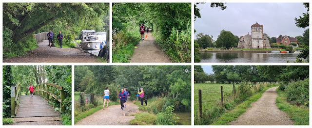
Please note that due to narrow sections on the course, double-width running buggies and dogs are not permitted at this parkrun venue. There is also a note on the course page advising those who wish to participate with a single buggy to contact the team in advance for advice on course conditions. So from the start, the participants start on a nice wide start line with plenty of space. Once reaching the path two anti-clockwise laps are completed. This includes a short stretch along the Thames past the moored boats, where you may also spot some of the resident swans. The wonderful suspension bridge provides a great backdrop to the view down the river.


With the two small laps completed, the parkrun route turns to head out of the park, heading south along the river. The out-and-back is simple to follow and there is absolutely no chance of getting lost. The main things to note are; there are a number of small wooden bridges to cross, they can be slippery in wet conditions, plus a couple of them feature quite a pronounced hump. The other thing to note is the path has some random chunks missing which could result in a dip in the river. Once you have seen these areas, the rules around buggies and dogs make perfect sense.

The river marks the boundary between Buckinghamshire and Berkshire, and the views across the river into Bisham, Berkshire are lovely. The main locations to note are Bisham's All Saints Church, which has a twelfth century tower, with further sections from the 15th century. It is quite an unusual, but nice looking building. Further along the river is the Grade I Listed manor house, Bisham Abbey, which originally dates back to 1260. It was built for the Knights Templar. The grounds are now home to Bisham Abbey National Sports Centre, which provides specialist facilities for elite athletes.


Towards the end of the out-and-back section, the land to the side of the path opens up and gives a lovely countryside view, complete with cows grazing in the field. The turnaround point is reached at exactly 3 kilometres into the course. The route back is just a simple case of following the river path back to Higginson Park where the finish is found back at the original start line.

For clarity, for the alternative course used on 5 August 2023, the finish line was in front of the house, but when the standard course is used, the finish line is located over at the skate park. It was only the exact location of the start and finish that were different; the rest of the course was identical. I have managed to get my hands on some GPS data for the regular course, so the link to that can be found at the bottom of the page along with my data, where you will also find links to Relive course fly-by videos.


Barcode scanning is taken care of straight after the finish line and once the participants, tail walker and the marshals are all safely back in the park, the team go to The M Cafe, which is adjacent to Court Garden. They have the usual selection of drinks plus a small selection of breakfast food items and the prices seemed fairly reasonable. If you decide to sit and eat outside, please take note of the 'Beware of Red Kites' signs; they apparently steal food. The results were processed and online a short while later and 123 people took part in event 158. This figure was slightly down on the average, which at the time of writing stands at 157.9. The range is usually between 120-200 participants. The slightly lower attendance during our visit may have been down to the wet weather.

I would also like to highlight that this venue does have its fair share of cancellations throughout the year. Some are as a result of other events using the park such as the Marlow Town Regatta, which is usually held in early June. The Pub in the Park event in May also leads to a cancellation. Some of the cancellations are due to course conditions. During wetter periods the river level rises and can completely cover sections of the riverside footpath, leaving no choice but the cancel. So it is definitely worth keeping an eye out on the event's news and social media pages. Also, anyone requiring an overnight stay will be pleased to know that there is a Premier Inn opposite the park. 


On the day we visited, the weather was miserable, so we probably didn't see the course and town at its very best, however it was still lovely, as were all the volunteers. After we had refreshed ourselves in the cafe and changed into some dry clothes, we had a little wander around the town, including a quick visit to Marlow's All Saints church which is next to the bridge. There was also a small market open opposite the park with some lovely looking artisan bread and other local products. We'd had a very wet, but very nice time in Marlow. A huge thank you goes to all of the volunteers that happily stood out in the rain and made the event possible.


Related Links:


GPS data (standard course)
Relive fly-by video (standard course)

GPS data (5 August 2023 - alternative start area)
Relive fly-by video (5 August 2023 - alternative start area)


Monday, 12 June 2023

Wendover Woods parkrun

Wendover is a town that sits within the Chiltern Hills Area of Outstanding Natural Beauty, in Buckinghamshire. The town was first recorded as Wændofron, and by 1086 this had evolved into Wendovre. The name itself is said to mean whitewater, and this is assumed to be a reference to the chalky stream that runs through the town.

It is known as an extremely desirable place to live and features 113 listed buildings. A row of thatched cottages near the centre of town were once owned by Henry VIII, who gave them to Anne Boleyn as a wedding present. Just outside the town centre is RAF Halton, which is one of the UK's largest RAF stations in the country. It has been in use by the military since 1913, but is due to close in 2027.


To the south-west and the east of the town, the Chiltern Hills rise, creating the stunning landscape for which they are famous. The focus of attention for this blog are the hills to the east; Boddington Hill and Haddington Hill. These both sit in the 800 acre area that is known as Wendover Woods. The woods, of course, take their name from the town and are managed by Forestry England. Interestingly, the area is recorded as Halton Wood on old maps, and the name Wendover Woods doesn't seem to appear until after the second world war.

The modern-day visitor attraction contains many marked trails, picnic areas, cafe, a playground, Gruffalo trail, and the Go Ape Treetop Adventure. I hear the woods have a stunning display of Bluebells during the spring. In September 2018 the woods became home to their very own free, weekly, timed, 5km event called Wendover Woods parkrun. The parkrun, like all others, is open to all abilities including those who would like to participate by walking.


We visited on 10 June 2023 to take part in the parkrun's 176th event. Travel to the venue is easiest by car and the site features a large on-site car park for which a fee is payable. The system in place during my visit is one where a camera records the vehicle's number plate upon entry and the fee can be paid by card or by other contactless method, such as a smartphone, at one of the machines at the Pay Station. Simply enter the registration number just before leaving and it will calculate the correct amount due based on the time spent on-site. The current parking charges are available on the Forestry England website. I did have a little trouble when leaving as the camera hadn't picked up my number plate upon entry. However the machines had an option to manually enter details as a back-up. Their website mentions they are putting plans in place for RingGo to be a payment option, but as of my visit this option was not live. 

If travelling by public transport you'd need to head to Wendover Station, and from there you could attempt to walk to the woods via Upper Icknield Way or possibly Beechwood Lane, but the route doesn't look straightforward and would involve some very steep inclines. It is noted on the official course page that the number 50 bus stops on Upper Icknield Way, but all the timetables I've seen online suggest that it only runs on Sundays. If using a bicycle there are a large number of racks available adjacent to the cafe building. Once on-site you'll need to head to the main central hub which is adjacent to the car park. The toilets can be found in the Wendover Woods Cafe building.


The first-timers' briefing is held near this area and the participants then head along the main path to the start area, near the GoApe centre, where the main briefing is held. Wendover Woods parkrun takes place over a single-lap (point-to-point) clockwise course which takes in quite a large amount of the overall woods.

The forest trail surface underfoot varies between stony and dirt based paths, and it can at times be uneven. During the winter months can also get quite muddy. The best shoe choice in the winter would be trail shoes, while in the summer months it'll come down to personal preference. Those with an aversion to wearing trail shoes should find road shoes are fine, but my personal preference would be to stick with trail shoes as they give a little more protection and stability on the stony and uneven surfaces. Buggy running is possible here, but it will be tough - the official course page advises awareness of the fast downhills and tough uphills.


The start line is just off the main wide path where the briefing is held and the opening section sees the parkrunners passing underneath the treetop obstacles which make up the GoApe course. This area is pretty much at the highest point of the woods. It then passes around the cafe where the route picks up one of the main walking routes through the woods.

The course starts to head downhill (past the Gruffalo) from this point and I would note that this section of path contains a fair amount of loose stones (larger than gravel). The path is nice and wide, so there's plenty of space for everyone. Just before reaching the 1 kilometre point, there is a downhill switchback to negotiate, so that was a cool memorable feature of the course.


The course continues to head generally downhill through the beautiful woodland throughout the next kilometre, and the descent gets fairly steep for a while. My GPS data registered this section mostly in the -6% to -8% region, but it did get as steep as -10% at one point. I found myself checking out the view while also trying to keep an eye on the terrain as it remains off-road with both embedded and loose stones. Just after the 2 kilometre point, the course generally starts to head back uphill. This starts in a gentle manner, but a few hundred metres later there is a right hand turn and the steepest uphill section is found. My Garmin recorded this mostly in the 9% to 12% window, but with a very brief point where it recorded 22%. This was followed by another downhill where the maximum descent was recorded at -15.6%.

There were of course some wonderful marshals dotted around the course, and they were generally placed on corners or where the path splits, ensuring no parkrunners or parkwalkers would take a wrong turn. Every now and then, in between marshals, there was the reassuring sight of a parkrun direction arrow. It is possible that you may cross paths with horse riders on certain paths, so of course keep an eye out for them (I spotted 1). You may also find the odd cyclist (again, I spotted 1), but out on the far reaches of the course, I didn't bump into any dog walkers or other members of the public. They seemed to stay concentrated within the main central hub.


During the second half of the route I found the surface underfoot became less stony and more dirt path, but still relatively wide. From the looks of some of the vehicle rut marks in the ground, it looks like it could get pretty muddy in this section.

At this point the course was working its way around the southern side of Boddington Hill, which was once home to an Iron Age hill fort (Boddington Hill Fort). It would have had a defensive bank and ditch on its east, south and west sides. The evidence suggests the fort would have covered an area of 10 hectares upon the hill. From the 3.2 kilometre point onwards, the course is all uphill. Thankfully the incline gets less severe the closer it gets to the finish, and the last kilometre generally feels almost flat. The location of the original briefing is soon reached and the finish is found back near the main central hub area.


Barcode scanning takes place right after the finish funnel and it's only a few metres to walk to reach the Wendover Woods Cafe, which is where the post event social is held - they had a good selection of food for all preferences, including a number of vegetarian and vegan options. The results were published shortly after and there were 160 finishers at event number 176. The official average number of attendees at time of writing is 141.1, but the actual number of attendees seems to bounce around in the 130-210 window. As I have mentioned above, I recorded the course with my Garmin and that data is online should you wish to check out the course map and elevation profile. I also used the data to create a fly-by video using the Relive app and that can be found on YouTube.

Once we had had a drink and some food in the lovely cafe (10% discount for parkrunners - show your barcode), we headed off to explore the woods a little more. A particular feature I was keen to find was the summit of Haddington Hill, which doubles up as the highest point in the whole of the Chilterns. After a few attempts of searching we found the right path. The summit itself is hidden within the woods to the north of the cafe area, and there is a cairn made from a set of four stones marking the spot. We wandered around a bit more and found part of the remains of the Boddington Hill Fort defensive bank and ditch. There are also a few viewpoints which give fantastic views of the surrounding countryside, and there is a fitness trail with various wooden pieces of equipment installed. In the end we visited the cafe three times to refresh and refuel before finally hitting the road home at around 4.30pm.


Wendover Woods is a beautiful place to visit, and it is such a brilliant location for a parkrun. The hills had made me nervous as I'm not quite as fit as I used to be, but I'm so glad I finally visited. Yes, the hills are hard work (I mostly walked the uphill parts) and this venue falls within the toughest 10% of parkruns in the United Kingdom, but it is also extremely brilliant. At the time of writing this is one of four parkruns that sit within the Chilterns Area of Natural Beauty. The others are Dunstable Downs parkrun, Church Mead parkrun and Henley on Thames parkrun. I have now visited three of them and they have all been stunning. 

The volunteers were fantastic, so I'd like to add a huge thank you to them for making the event happen.


Related Links:


Dunstable Downs parkrun (blog7t write-up)
Church Mead parkrun (blog7t write-up)


Sunday, 28 May 2023

Church Mead parkrun

Amersham is a town which sits within the Chiltern Hills, in Buckinghamshire with a population of around 15,000 people. The earliest records of a settlement here go back to at least Anglo-Saxon times when it would have been known as Agmodesham. Other versions of the town's name have been Elmodesham, Agmondysham, Amytysham and Hagmondesham. The name is said to derive from the Old English term meaning Ealhmunds Village. The early settlement was located within the valley of the River Misbourne and this is the part of the town which is now referred to as being Old Amersham or Amersham Old Town. The modern expansion is based around the railway line which arrived at the end of the 19th century and is known as Amersham-on-the-Hill.

amersham old town

The newer part of town has grown steadily since the turn of the 20th century thanks to its direct rail link into London which has made this a popular commuter town. As the name suggests, this part of town is up on the hill, and most of the buildings date from the 1920's onwards. Some of the houses were created as part of the Metro-Land project which saw surplus land owned by the Metropolitan Railway used for house buildings projects. A few notable buildings are the High & Over House, which is a grade II Listed building which was complete in the 1920's. There was also once an Art Deco theatre/cinema called The Regent, but sadly this was closed in 1962 and demolished to make way for a supermarket soon after.

Old Amersham is centred around its historic High Street, and this part of town contains over 150 Listed Buildings from various periods from pre-Tudor times onwards. It is said that the high street looks very similar to how it would have during the 1700's. The town was once owned by relatives of Sir Francis Drake, and the family still have links to the town. St. Mary's Church, which is the town's oldest building, was founded in 1140AD. The current building was built in the 13th century and it was further enlarged during the 14th and 15th centuries. The church occupies the site of an earlier Norman building of which a few sections still remain. The north side of the church contains the Drake family chapel and their family tomb is located in a vault directly below.

st mary's church / cemetery / church mead

The churchyard is home to some extremely rare tombstones called 'body stones' which have an unusual shape to them. Apparently the only other tombstones of this design can be found in Westerham, Kent. Next to the churchyard is a beautiful remembrance garden containing a war memorial and St Mary's Cemetery is located just beyond this. A notable burial in the cemetery is that of Ruth Ellis. She was convicted of murder and in 1955 became the last woman to be hanged in the United Kingdom. She was granted a posthumous conditional pardon in July 2026. Additionally Church Mead (meadow) is a small, grassy area adjacent to the church and this lends its name to the town's free, weekly, timed 5km event called Church Mead parkrun.

The parkrun has been a feature of the town since 9 April 2022 when the inaugural event was held. I visited the town on 27 May 2023 and took part in event number 59. As I have alluded to above, the town has a train station and this is simply called Amersham Station. It is located within the Amersham-on-the-Hill part of town and is served by national rail trains running on the Chiltern Railways between London's Marylebone Station and Aylesbury, and also by the London Underground's Metropolitan Line. The station actually falls within the London Underground's zone 9, so it is possible to travel using an Oyster card despite being outside London. Once arriving at Amersham the last leg of the journey involves heading down either Station Road towards the Old Town (just over 1 kilometre).

start

There are also buses that pass through the old town, with the closest bus stops being on the main road near the large Tesco. Driving to the town is of course possible, and the closest car parking option is Amersham Old Town car park which is right next to Church Mead. The car park requires a fee to be paid and this can be done via the payment machine or by using the RingGo app. As an alternative, the High Street to the west of Old Amersham Market Hall is completely free of restrictions, so you can park for free for as long as you like only a few hundred metres away. For cyclists, I don't remember seeing any bicycle racks anywhere in Old Amersham, so it may be a case of looking around for a suitable place to park up. Finally there are public toilet facilities available within Amersham Old Town car park.

The meeting point for the parkrun is on Church Mead, just in front of the cemetery and adjacent to the river. The official course page advises parkrunners not to enter Church Mead via the Memorial Gardens, but instead enter from the car park, but access is also possible via the church yard. Both the first-timers and the main briefings take place here, but a special mention should go to the creative and theatrical presentation of the first-timers briefing on the day I visited. I hear this is a regular feature and it was certainly an interesting way to present it.

barley fields

The main bulk of the course is nestled into a large triangular patch of land which sits in-between the old and new sections of the town, and consists of two mostly-off-road, anti-clockwise laps. I understand it can get pretty muddy at times, so it is predominantly a trail shoe course. It is also hilly and has quite narrow paths. With all that in mind, it's not the most buggy running friendly course, so there is a note for buggy runners to contact the team for advice before visiting. Once the briefings are done, the parkrunners move onto the grassy area on the very edge of the car park to form the start line.

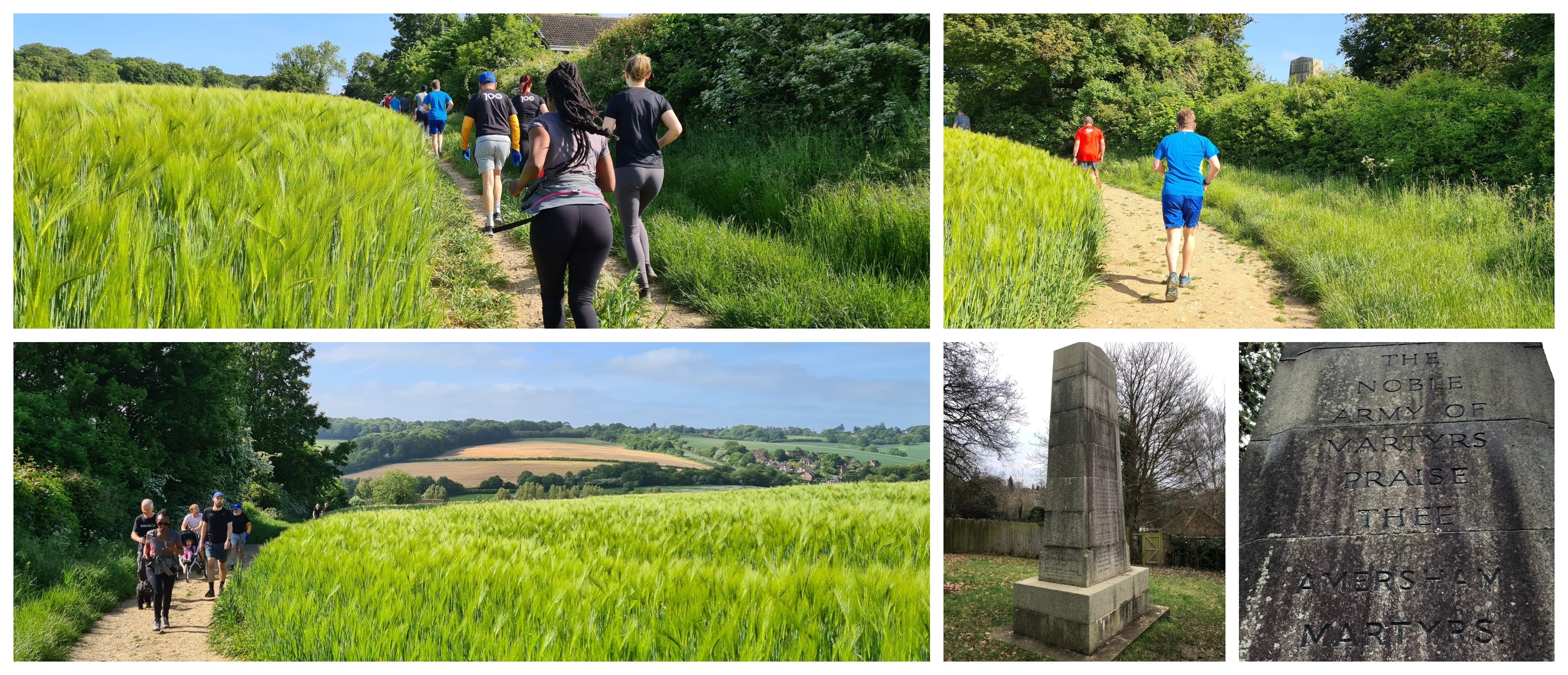
The opening section of the parkrun is likely to be quite congested so it is wise to self-seed appropriately. After weaving along the narrow path through Church Mead, the course crosses the river via the small stone bridge and then follows the cemetery's boundary wall around until reaching the wide open barley fields behind. This point marks the start of the lap. The route continues to follow the boundary of the cemetery, the elevation rising and falling gently until the end of the wall where the path continues alongside the River Misbourne for a short stretch. At the south-eastern tip of the course there's a left-hand turn and the route begins its long journey uphill.

photos of the the amersham martyrs memorial courtesy of richard gower

The off-road path underfoot is embedded with chunks of flint, so care is required at all times. As the path works its way up the hill, there's a moment where the top section of a memorial stone can be seen behind the bushes. The stone is the Amersham Martyrs Memorial and it commemorates the seven residents of Amersham that were burned at the stake in the 1500's. They were Lollards who wanted to reform the Catholic Church, their main demand was to be able to read the bible and worship in English. The uphill slog continues up along this side of the fields until reaching a marshal at the entrance to a wooded area called Parsonage Wood.

The section in the woods begins with a slight dip in elevation, but the uphill theme is resumed shortly after. The surface underfoot continues to be precarious, as along with chunks of flint, there are also tree roots (and over the winter months a fair amount of mud) to deal with. On the day I visited I found that the lighting in the woods made it quite difficult to identify any potential trip hazards up ahead. In fact there was a lady who tripped and fell. The woods are quite beautiful and clearly very old. The highest point of the course is reached at the northern end of the course where it meets the adjacent road, Rectory Hill. After about 200 metres of some flat terrain, the course begins its descent.

parsonage wood

As the course descends there is a gully which runs along the path, which could also be a trip hazard, so watch out for that. The downhill section is shorter than the uphill, which of course means it is steeper. As the course exits the woods, parkrunners are treated to a fantastic view across the valley and onwards towards the hills and fields beyond. The path downhill is part tarmac so it is a sensible idea to stick to the smoother surface and avoid any potential trip hazards. At the bottom of the hill the course reaches the corner with the cemetery and a second, identical, lap begins.

At the end of the second lap, the course follows the cemetery boundary back around towards Church Mead where the finish is found in-between the cemetery and the river. After the finish line there is a small wooden bridge which can be used to cross back onto the main Church Mead grassy area where the barcode scanning takes place. Once all the parkrunners have completed the course and all the signage and marshals have returned, the team heads over to Seasons Cafe for the post-parkrun refreshments and social. They have a wonderful selection of breakfasts, cakes, pastries and drinks.

the view

I recorded the course using my Garmin and the course data can be viewed on Strava. The data was used to create a course fly-by video using the Relive app, and that can be viewed on YouTube.

The results for event 59 were published later that morning and 117 people took part. That is a little higher than the average, which is currently 100.5, but it's also not unusual for the turn out to be in double figures. It's a really nice, scenic, challenging course. I'd like to extend my thanks to all of the volunteers involved in putting the event on and making my visit a very enjoyable one.

finish / church mead


I continued the rest of my morning by exploring the Old Town. St Mary's Church, Old Amersham Market Hall, and The Kings Arms pub are notable buildings which I made sure to see. The Crown Hotel was used as a filming location for a scene in the 1994 film Four Weddings and a Funeral. While on the subject of filming, the town was also used in Midsomer Murders, Sky TV's Midwich Cuckoos, the 1973 Metro-Land documentary and the 1997 Metroland film. Then there was this from Taskmaster which was filmed on Church Mead. Lastly the BBC sitcom Cuckoo has many scenes filmed in town, and there's even a choreographed umbrella dance scene in the Memorial Garden. 

While wandering around I couldn't believe how many locals stopped to talk to me. I think this may be the friendliest town I have ever visited!


Related Links:


Sunday, 10 June 2018

Buckingham parkrun

Dating back to the 7th century, Buckingham was established in a naturally good defensive position in a loop of the River Great Ouse. Its name is said to come from 'Bucca' who was the leader of the first Anglo Saxon settlers - the literal translation of Buckingham is 'meadow of Bucca's people'. The river formed the border between the Saxons and the Danes and Buckingham changed hands many times over the years.

buckingham

In the 10th century Buckingham became the county town of Buckinghamshire - at this stage and for many years this was an important and prosperous place. It had its own mint producing silver pennies and in 1554 received its Royal Charter. In 2014 a metal detectorist found a huge coin hoard in a field just outside the town, it contained over 5,000 silver coins and is known as the Lenborough Hoard - it has recently been valued at £1.35 million.

In 1703 The first Duke of Buckingham and Normanby built a townhouse called Buckingham House in London which was acquired by King George III in 1761. A major enlargement project took place in the 19th century and it was renamed Buckingham Palace. It became the official residence of the Monarch in 1837. Whilst in Buckingham, the Duke would have resided in the magnificent Stowe House, which is now Grade I LIsted and owned by the National Trust.

parkrun briefing and start

Turning our attention back to Buckingham, the town was a major centre for a wide range of industries including tanning, candle making, goldsmiths and many more. However the good times didn't last, famine, a devastating fire in 1725 which destroyed about a third of its dwellings, and being hit extremely hard by the plague, the town had a final twist of the knife when, in the 18th century, it was replaced as the county town by Aylesbury.

Modern day Buckingham is a delightful historic town with many narrow windy streets, and despite the fire has a fine collection of historic buildings - Georgian architecture is widespread in the town and these buildings were built to replace those that suffered in the fire, but there are a fair number of older timber framed buildings still standing. A Gaol which was originally built in 1748 still stands and is now a museum.

opening stretch

The site of the original settlement now houses the University of Buckingham which is the only university independent of direct government support in the UK. The town itself has spread mostly to the north and west of that original settlement in the loop of the River Great Ouse and boasts a population of around 12,000 people. At time of writing it is also represented in Parliament by the current Speaker of the House of Commons.

I visited the town in June 2018 to take part in Buckingham parkrun which has been in operation since May 2014. Attendances have grown steadily in that time and at time of writing you'll probably find a field of just under 300 participants every Saturday morning. It takes place along the banks of the river and its route meanders around two different parks.

bourton park

Travelling to Buckingham by car is fairly simple and parking can be found in Cornwalls Meadow Car Park for a very reasonable 50p for up to three hours. It is just a couple of minutes away from the start area, which is located next to the Bridge Street Skate Park. Those who travel by bicycle are advised to use the bike racks at the local Waitrose supermarket. Toilet facilities can be found in the car park.

For anyone wishing to arrive by train, sadly this is no longer possible. When the railways were being built, the original plan for the London-Birmingham railway included Buckingham on its route. However the 2nd Duke of Buckinghamshire opposed this, fearing what would become of the town so the L&BR changed their plans. A number of years later, a branch line did run through the town and was fairly successful as a goods route. Sadly the passenger services were not very popular and the line was gradually closed down during the 1960s.

bourton park

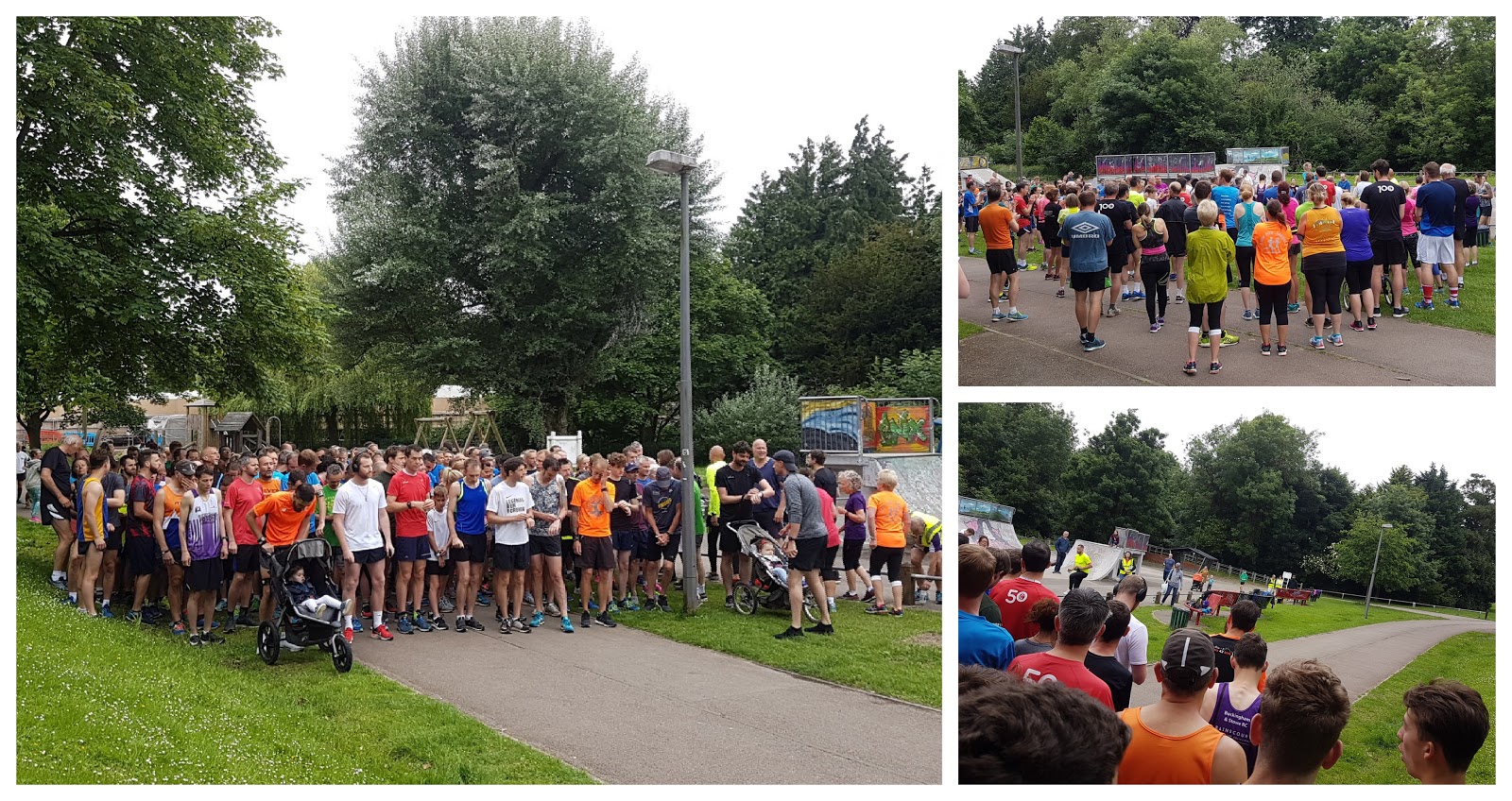
So after parking the car and heading off for a quick jog around the town centre, I arrived at the Bridge Street Skate Park just in time to listen to the run briefing. After that, the day's participants were set off on their regular Saturday morning run. jog or walk around the picturesque riverside course. Underfoot is all tarmac, so road shoes are the way to go all year round. The course is mostly flat and fast, and perfectly fine for a spot of buggy running.

The course layout is that of a lollipop - the official description is 'you run out on the stick, lick the lollipop twice, and then run back along the stick'. Starting at the Skate Park, the course heads through the area known as Heartlands. Travelling to the north along the winding Buckingham Circular Walk path until at around 600m there is the first crossing of the river via a fairly wide bridge. This brings the route onto the Ouse Valley Way where it follows the course of the river.

bourton park

At around 1 kilometre into the run, the course enters Bourton Park and there are now two anti-clockwise laps of this park to complete (the sweet lollipop section). The paths generally meander left and right, which gives a great flow and is very enjoyable to run. The loop also includes a couple fo narrow bridges to cross. Once the two laps are complete, the route leaves this park and heads back along the outbound route all the way back to the Skate Park.

The whole route is flat except for the opening and closing 400 metres or so, where the paths gently passes over some very mild undulations. Once back at the Skate Park, barcode scanning is taken care of by the volunteers and once everyone is finished it's time for a spot of breakfast. Before heading off for breakfast, if you have run a PB you can have a quick ring on the PB Bell, which is great fun. The officially listed spot for post-run social is at the Gelateria Gazzeria where you can get some light refreshments.

finish [thanks to my wife for the photos of me finishing]

We chose to head into one of the local tearooms for a more substantial breakfast before spending some time exploring the town where we visited the Old Gaol (who have a small display of coins from the Lenborough Hoard) and The Chantry Chapel which is Buckingham's oldest building. We rounded the day off with a visit to Gelateria Gazzeria and I had some fantastic melon sorbet which I hear is made onsite.

The results for event 218 were published shortly after and 240 people took part. I recorded the run with my Garmin and uploaded the course to Strava, and as always I transferred that data to the Relive app on my phone where a course flyby video was generated. It had been a great morning out and I enjoyed my run very much especially the meandering paths. A huge thank you to all the volunteers.

scanning / pb bell / refreshments

Related links:

Saturday, 17 February 2018

Linford Wood parkrun

I last visited the New Town of Milton Keynes, which forms part of the ceremonial county of Buckinghamshire, back in 2014 when I ran at Milton Keynes parkrun (my blog). In the time since my visit, attendance numbers had began to creep up into the 500's (occasionally into the 600's), and the town was really in need of a second venue. In July 2016 that second venue went live and its name is Linford Wood parkrun.

linford wood (parkrun)

Finally in February 2018 I got around to visiting the event which, true to its name, takes place in Linford Wood. I drove and parked on Foxhunter Drive which is adjacent to the start line. There is also an official car park located a short distance away off of Breckland Road. Had I been local and cycled, I would have used the bike racks outside the venue's post-run breakfast venue, Ora Cafe, which is in sight of the finish line.

If I had travelled by train I would have alighted at Milton Keynes Central train station which is just over 2 miles away and covered the rest of the journey on foot as a warm-up jog, but there are also bus services that will help you complete the journey - I'd advise checking these independently as they may be quite infrequent. For the record, there are no toilet facilities here - actually there is one in the cafe but it is only for customer use and I believe only post-run. As I had been driving for 1.5 hours, I decided to have a quick pit-stop at a local McDonalds en-route.

the opening stretch

Linford Wood covers an area of 97.1 acres and is the oldest remaining woodland within Milton Keynes. Eighty percent of the area has been continuously wooded for at least 700 years and this gives it Ancient Woodland status (I visited a parkrun in ancient woodland the previous week as well), the other twenty percent are trees that have been planted at later dates. The mature trees in the wood are predominately Ash (60%) and Oak (31%). During the spring, 'swathes of Bluebells' appear, creating a beautiful sight.

It would have been part of the Manor of Great Linford and in 1284 was enclosed by Baron Ralph Von Pippard as a deer park (for hunting) and for pig pannage (releasing domestic pigs into a wood in order for them to forage for acorns, nuts etc..). At one time the wood would have been connected to the village of Great Linford (and the Manor House) by a tree-lined lane.

underpasses

When Milton Keynes was designated a New Town in 1967 the wood was retained as a haven for people and for wildlife. It sits in its own Linford Wood grid square, which also features a few office and industrial units. It is still home to deer and many other species of wildlife including bats, birds, amphibians and reptiles. The latter two finding homes in and around the wood's seven ponds. Pathways were laid in the early 1970's to give the local community good access and many of these are still in use today.

Upon arriving in the woods, the meeting point and start area was very easy to find as it was visible from my parking spot on Foxhunter Drive. The main run briefing takes place next to Keeper's Cottage Pond and the participants then move over to the start area which is in the north-east corner of the woods. The 5 kilometre run takes place over one single lap which covers a large part of the woods and some adjacent areas.

a made a new friend during the run

Underfoot is 100% hard surfaces (tarmac or similar) so road shoes are the way to go all year around, and the course profile is basically flat with the exception of the occasional underpass slopes which are all encountered during the first 2.5km of the run. The average attendance is about 180, but be warned that if Milton Keynes parkrun cancels, this is likely to jump up to around 500.

From the start, the participants head in a southerly direction along the eastern border of the woods. In fact the first half of the run is exclusively run on the Milton Keynes Redway System (Redways) which are a network of shared use pedestrian/cyclist footpaths. The redway name has also found its way into the local running community, with Redway Runners being the name of one of the local running clubs - very well represented I must add.

stanton wood and back into linford wood

At 800 metres into the run, the course leaves Linford Wood and enters the residential grid square of Conniburrow via the first of four underpasses that are part of the route. After following the Redway through the first three of these underpasses (via the adjacent grid square of Bradwell Common), the course returns to greener pastures as it follows the redway along the border of Heelands Sports Field and Stanton Wood - this wood, which is not ancient woodland, used to be contiguous with Linford Wood, but the main road now separates the two.

Once through the final footpass, the second half of the run takes place wholly within Linford Wood. The paths here are a little narrower than the redways, but as the field would have thinned out considerably, it doesn't cause a problem. After travelling through the western part of the wood, the course then turns towards the centre. It's worth noting that around here is a separate path containing a nature art trail - it's not part of the course, but it features some brilliant wood carvings in old tree stumps.

into the woods...

Anyway... just after the 4 kilometre point, the fun really begins. If you've read my other blogs you will know I'm a fan of twisty courses, because, well, they are so much fun. This next section features, I think, 17 corners which alternate from left to right. They are all quite meandery (ie no tight corners), and flow extremely well. Brilliant!

Finally the course emerges from the woods back at the original meeting point at Keeper's Cottage Pond where there is a 250 metre stretch to go before reaching the finish line. Barcode scanning takes place here and then it's time to head into the adjacent office/industrial area where the Ora Cafe can be found. I headed back out onto the course to continue taking photos for the blog (they have a very smiley, wavey bunch of runners here! Also there's an album on flickr) and before I knew it had run out of time and had to leave, so sadly didn't get the chance to sample the breakfast.

the last 300 metres and the finish

I had recorded the run with my Garmin and you can view the course data (hill profile etc) on Strava. I also created a course fly-by video with the Relive app on my phone. The results were online before I arrived home and event 87 had attracted a total of 276 attendees. As always, a massive thanks goes out to all of the volunteers who were fab - I had a great time!

Links:


Sunday, 21 January 2018

Wycombe Rye parkrun

The town of High Wycombe sits next to the River Wye in Buckinghamshire. At first glance it may appear that the town was named after the river, however records show that the river itself was not named until the early 1800s while the town itself was first recorded as Wichama in the year 799 and subsequently Wicumun in around 970. The town currently has a population of around 120,000.

Over the years High Wycombe has been home to a few different industries. The river was key to a lot of these with the water being used to power various mills - corn mills came first, followed by fulling mills which were used in the cloth trade, and then paper mills. Lace making was also once very popular in the town. In later times, the furniture industry started with simple chair making and the town went on to become known for producing high quality furniture.

wycombe rye

Long before all of that, in around 150AD, the Romans had built a villa on the site of Holywell Mead which along with Rye Mead, now forms what is known as Wycombe Rye, or simply The Rye. The remains of the villa were discovered in the 1720s by workmen. Archeological digs conducted in 1862, 1932 and 1952 found artefacts and a Romano-British mosaic floor. The site is underneath the Wycombe Rye Lido swimming pool complex so cannot be viewed, however I hear that the Wycombe Museum is a good place to visit for more information.

The Rye has a long history and is most notable for being used as a grazing area. Locals would walk their cattle to The Rye each morning and collect them at the end of the day. This was until 1927 when an Act of Parliament stipulated that the Rye could thereon only be used for recreation. It was also once a water meadow and, with The Rye being very low lying, is still a flood plain for the river. Flooding is more common during winter and spring, but flash flooding in the summer is also possible.

start

The modern-day Wycombe Rye area has a Green Flag Award and features open playing fields, a children's playground, an adventure playground called 'Ropes on the Rye', an outdoor swimming pool (the lido), Pann Mill and gardens, and The Dyke which is a long man-made expanse of water used for boating and fishing.

I had travelled to High Wycombe on a cold, miserable morning, by train from Central London to take part in event 282 of Wycombe Rye parkrun. It's a free, inclusive, 5km event which has been taking place on The Rye on Saturday mornings at 9am since August 2012. The train station itself is just a short walk away from the park, so was very convenient (approx 10 minute walk to the meeting point). The main reason I had taken the train was because the popularity of the event has lead to some parking issues and I was keen to keep my impact on this to a minimum.

paths during the first km / pann mill

If I had driven I would have parked in one of the local car parks - the main onsite car park is Holywell Mead car park which I understand costs 50p for two hours. It has 114 spaces and with the parkrun currently attracting around 500 participants each week, it does fill up quickly. During my walk from the train station, I saw that there is definitely no shortage of car parking in the local area, and the alternative car parks are listed on the event's official course page, which also has comprehensive details of local bus services. For cyclists, there is a small bike rack located in the car park.

The course is multi-terrain with the majority being run on hard surfaces and the rest on grass. Given that it was winter when I visited, I ran in my light trail shoes just to give me a little extra grip on the wet and sightly muddy grass areas. The course could be described in a few different ways - a lollipop, or an out-and-back, but I've settled on using 'spiraling, out-and-back lollipop'.

wendover way / the dyke

The meeting point for the run is on the grass outside the Lido, and as the air temperature was cold, the steam rising from the pool looked incredible as it hung in the air while the adjacent Warren Wood and Keep Hill Woods provided a stunning tree-lined backdrop.

The toilets are conveniently located right next to the car park and the meeting point. The main run briefing takes place at the really wide start line which is about 100 metres away, and everyone is then sent off to complete the 5 kilometre course. It starts on the grass and spirals in an anti-clockwise direction, reaching the main path which follows the northern border of the park alongside the River Wye.

water cascade and the steps!

At the north end of the park, the course passes the formal gardens and Pann Mill which is still in working condition. It opens during the summer and it still grinds its own flour. Also in the corner of the park is the water pumping station which pumps 9 million gallons of water from 250ft undergound into a nearby reservoir.

The course cuts across the corner of the 'Ropes on the Rye' adventure play area and onto Wendover Way - named after Viscount Wendover, who died aged 20 after being wounded at the second battle of Ypres during the First World War. Some land and the Grade II listed War Office iron railings were donated to the town in his memory. Heading onwards, the course makes its way towards the Dyke, which was landscaped in the 18th century as part of the adjacent Wycombe Abbey school grounds (at that time it would have been called Loakes Manor).

heading back

After crossing to the southern side of the Dyke, Wendover Way becomes a little narrower and is split into two lanes - one for people and the other for cyclists. The tree-lined path runs along the edge of the dyke, rising ever-so-slightly in elevation, all the way to the eastern end of the park.

This is where you'll find the sweet part of the lollipop - participants keep to the left-hand-side where the path forks and then head down a short, sharp decline onto football fields for a single grassy, clockwise loop. At the end of the loop, at about 2.8km into the run, the course crosses a tiny bridge and you find something that is not often seen at parkrun - steps!

grassy/muddy section and the finish

There are about 20 steps to negotiate as the path curves around to the right. Interestingly, they do not get a mention on the official course description page. If you are a buggy runner, fear not - there is also a step-free slope that you can zig-zag up as an alternative. At this end of the course, you may also spot the picturesque waterfall/cascade. Heading back along Wendover Way can be pretty busy with two-way running traffic so care is needed along here (especially if you end up in the cyclists' lane).

From here the participants simply retrace their steps all the way back to the finish area outside the lido. When the full course is complete, the wonderful finish funnel team will be waiting to register your finish time and hand you a token which is then scanned along with your own personal barcode by one of the volunteers on scanning.

token board / lido

At this venue, after scanning, the position barcode is given back to the participant where they proceed to hang it on the appropriate nail on one of the finish token boards. During the busiest period of finishers there was a bit of a queue to do this, but it's a great opportunity to get to know your fellow parkrunners. Once all of the morning's participants have crossed the line and the equipment packed away, the post-run gathering takes place in the Lido Cafe.

I had recorded the run using my Garmin and the GPS course data can be viewed via my Strava account, which is here: Strava - Wycombe Rye parkrun. I also used the relive app on my phone to create a course fly-by video and you can watch that on youtube, here: Wycombe Rye parkrun course fly-by. The full results for event 282 were processed and online a short while later. The miserable weather had culled the recent high attendances and there were 386 participants in total on the day I visited.

Related Links:


Related Posts Plugin for WordPress, Blogger...